EN
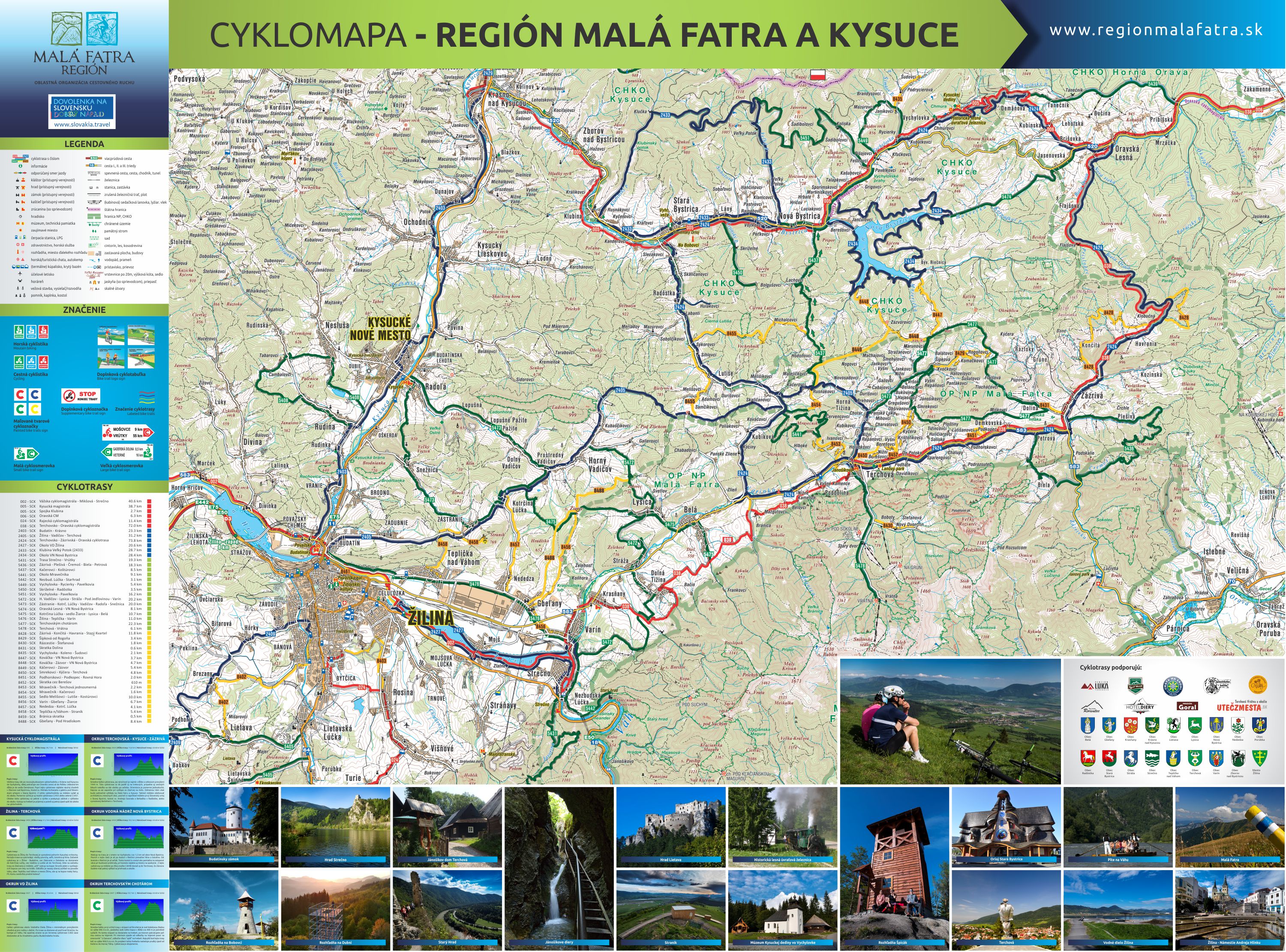
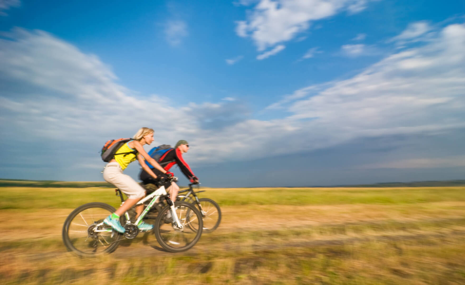
Hundreds kilometres of cycling routes from easy to strenuous ones that will lift you off the saddle. Welcome to a cycling paradise of Slovakia – Malá Fatra (Little Fatra) region. There are routes for adrenaline riders and families with children across flats and mountains. Enjoy the beauty of nature and gorgeous views from bike’s saddle and join cycling enthusiasts!
The Densest Network of Cycling Routes
Did you know that the densest network of cycling routes in Slovakia is around the village of Terchová? Right there opposite the church, there is a point where most of the cycling routes in Slovakia start. Whether you are a recreational cyclist or a devotee of strenuous mountain cycling, you will certainly choose from a rich variety of cycling routes. Cycling routes around Žilina, Terchová or Bystrická dolina (Bystrická Valley) are perfect for families with children as well as for the most demanding cyclists.
Bike Coach
Dust your bikes, grease your chains, inflate your tires and take a drive with your two-wheel steed to attractive cycling routes.
Undemanding straights across meadows covered in flowers, little ascents with gorgeous views and even strenuous routes for the true cycling enthusiasts – Malá Fatra (Little Fatra) almost allures you to come and grab your bike. Did you know that thanks to 645 kilometres of routes, we call it a real cycling paradise for cyclists?
In order to make transport with two-wheel vehicles as easy as possible, bike coaches are ready for you also in summer 2018 thanks to the support of Žilina Self-Governing Region.
Do not miss Kysucká cyklomagistrála (Kysuce Arterial Cycle Route – accessible from bus stops Krásno Nad Kysucou, Stará Bystrica and Nová Bystrica), Vodné dielo Žilina (the Žilina Dam) with a cycling route from Strečno (the Strečno Castle) to Budatín (the Budatín Castle) (from bus stop Varín), cycling routes with spectacular views at Malá Fatra (Little Fatra) foothills or Kysuce highlands from bus stops in Belá, Terchová and Vrátna.
Reserve your seat on a bike coach and do not worry there are no seats left. The best way to discover the Malá Fatra (Little Fatra) region is on your bike!
Website: www.sadza.sk/cyklobus
Cycling Routes
Do you find active holiday in Slovakia attractive? Discover the beauty of unique natural scenery of Malá Fatra (Little Fatra) region on two wheels. Cycling trips will certainly please your children, too. Choose one of the cycling routes offered or get inspired by historical and cultural monuments of the region and make your own cycling trip plan.
Newly built cycle route showing the beauties of the Kysuce region goes through a cycle path, so you do not need to worry about your children’s safety. Kysucká cyklomagistrála (Kysuce Arterial Cycle Route) goes across from west to the east, and it connects some Kysuce villages through Oravska Lesná and Novoť with Polish borders.
The cycle path runs across the valley of Bystrický potok (Bystrica Brook), and it has a minimal height difference, so even little cyclists will make it from any end. Pack some snacks on the way, in case your stomach starts growling, and visit all Kysuce attractions. Do not be ashamed to get off your bike, stop and relax while reading information boards describing tourist attractions around you. Visit a mammoth in Krásno Nad Kysucou, walk across one of the oldest bridges from the Austro-Hungarian period, look into WWII bunkers, and plan the longest stop at Rínok sv. Michala (St. Michael’s Square) in Stará Bystrica. Take a rest after travelling by bike and wait for a stunning show of the first and the only Slovak astronomical clock. If your feet do not hurt yet, run up the lookout tower on Bobovec (Bobovec Hill) or continue to Nová Bystrica where you can find the Museum of Kysuce Village and logging switchback railway.
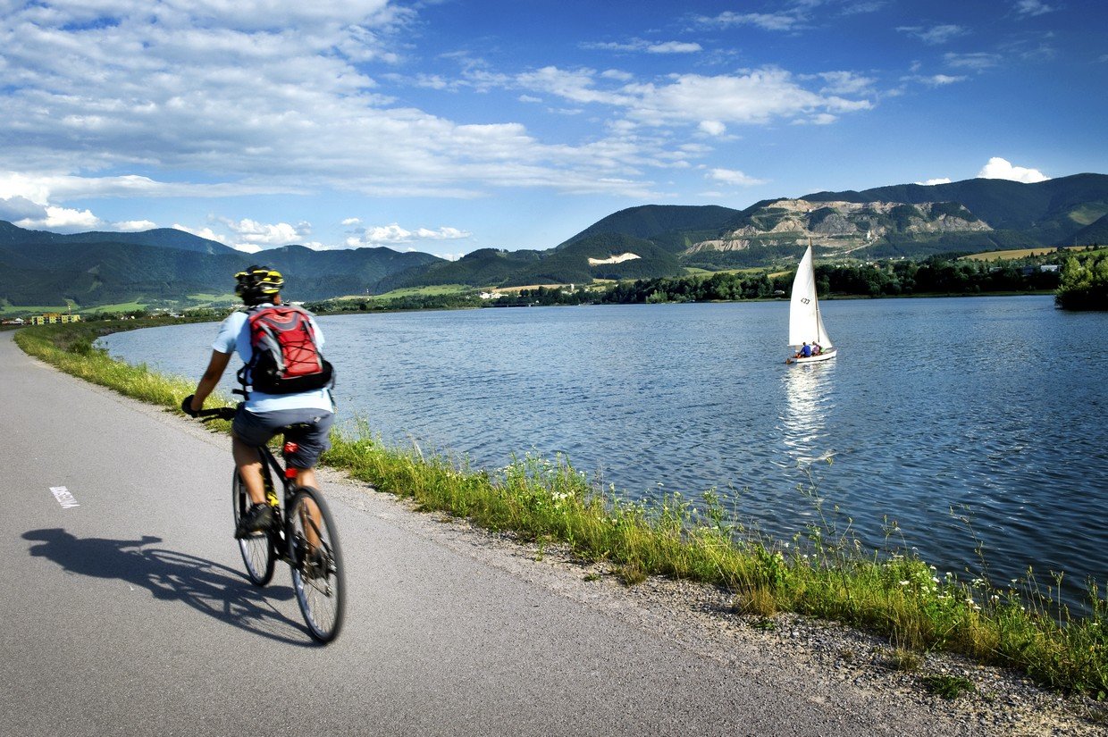
Route around Vodné dielo Žilina (the Žilina Dam) offers perfect conditions for families with children as well as for active seniors. Would you believe that there is no need to leave the city in order to experience a real cycling trip?
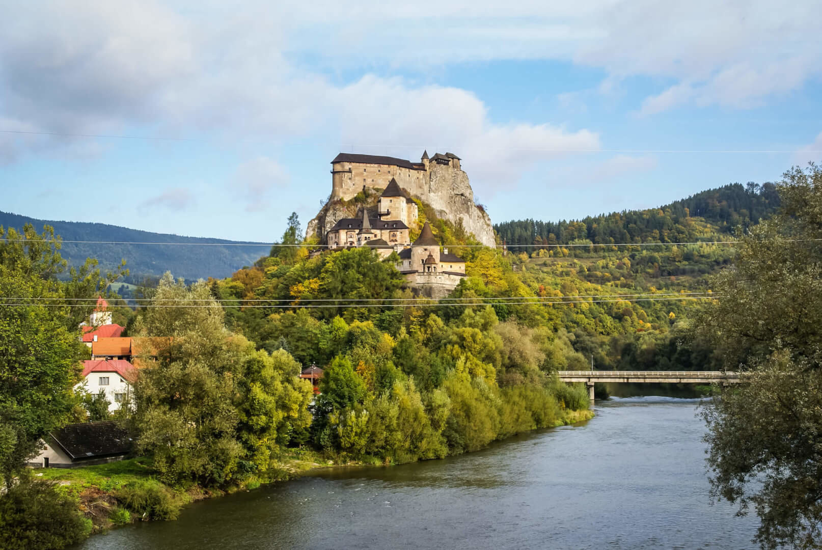
Start your family expedition with a royal picnic in the garden of Budatínsky hrad (the Budatín Castle). Follow cycling signs across the castle park. It is not possible to ride a bike across other routes in the park. There are rest areas and shelters on the way from the castle park to Vodné dielo Žilina (the Žilina Dam). Ride around the dam and stop to refresh yourself on a terrace of one of the restaurants that can be found there.

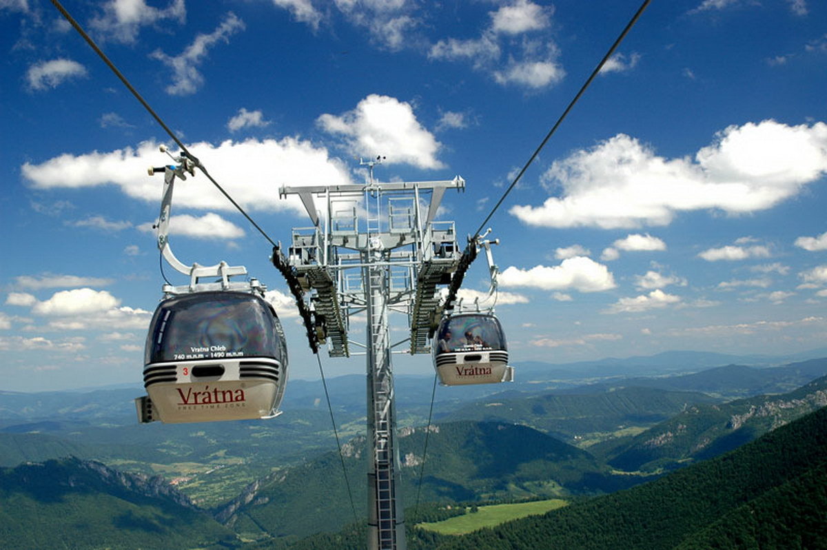
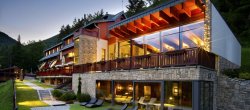
An example of easy cycling route intended for beginner cyclists. Follow green signs from Terchová to Vrátna, below the cable car to Vrátna Cottage. Stop by stone formations resembling all kinds of things. For instance, would you find a monk? If you still do not have enough, and your feet would make it, on your way back turn left to Sokolie and visit Wellness Hotel Rozsutec. Enjoy sweet rewards on restaurant’s outdoor terrace with a gorgeous view of Malá Fatra (Little Fatra) peaks.

The route starts at Budatínsky hrad (the Budatín Castle). Park your two-wheel steeds for a moment and take a look at a permanent exposition of tinker craft or just relax on a gorgeous green lawn under a hundred-year-old linden tree in the park. Continue to Zástranie and go up the hill up to Straník; from there you can enjoy unforgettable views of Žilinská kotlina (Žilina Basin). Follow the route across the city part of Zádubnie to Kotrčiná Lúčka; through Vadičov and Lutište you get to the village of Terchová. Do not hurry from Terchová and try something from a wide range of indoor and outdoor activities. Wooden Nativity scene, Stations of the Cross, cableway or a train ride – which one would you choose?
Our mountainous region Kysuce has a lot to offer to the cyclists, too. Enjoy this pleasant route. The route sets off towards Vychylovka approximately 1.5 km away from Nová Bystrica village. On the way, you will pass Riečnica Church that remained there to commemorate villages sunken during the construction of Nová Bystrica water reservoir. There is also a place for barbecue close to the church. However, we recommend you to go on to the water reservoir following blue signs to Zázvor, from where there is a beautiful view of the water reservoir and its surroundings. This place is a true paradise for mushroom pickers. If you are lucky, you would leave with a basket full of these forest gifts.
Route suitable for road cycling as well as for occasional recreational cyclists. Before you set off, stop by the church. Have you ever seen such a detailed moving Nativity scene? Set off from Sts. Cyril and Methodius Church in the village of Terchová in the direction of Zázrivá. First warm-up hill is waiting for you after five kilometres. From there to Zázrivá, it goes smoothly. Turn left at the crossroad towards the centre, further in the direction of Zázrivá Havrania. Refresh yourself after an ascent and before another demanding climb. From Veľká Havrania, a ten-kilometre-long ascent to Hoľa Saddle 1050 metres above the sea level is awaiting you. Continue in the direction of Oravská Lesná to the centre, turn left at the crossroads towards Vychylovka, Stará Bystrica, where the Museum of Kysuce Village is worth visiting or refresh yourself with a pint of beer. From Nová Bystrica you can take a new Kysucká cyklomagistrála (Kysuce Arterial Cycle Route) to Radôstky. From Radôstky continue on the road to Lutiše. Last hill of the route leads to Lutiška Saddle. From Lutiška continue to the crossroads Belá-Kubíková and back to Terchová. After such a strenuous route your body is almost asking for relaxation. Visit the sauna world of Diery Hotel; it will not let you down.
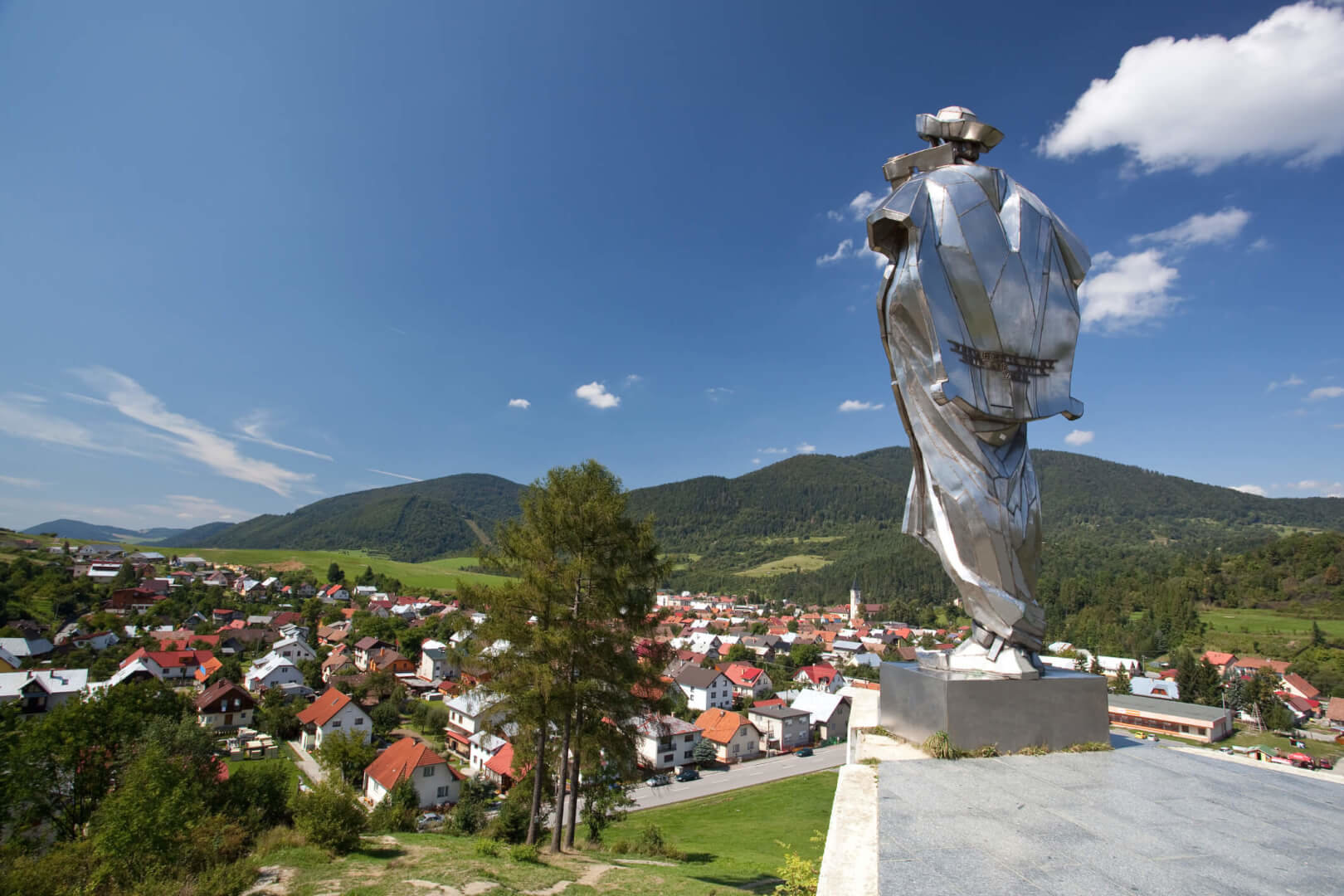
Get to know the Terchová area from bike saddle. Discover beauties and secluded places hidden in Terchová and its surroundings. Cycling route over the Terchová area is moderate. The first peak of the route ascending from Struháreň is above Holešova Skala (Holešova Rock), 846 metres above the sea level. It is necessary to get off your bike and walk the last part of the hill, approximately 400 metres. After strenuous climbing you will reach the ridge from where you continue on the unpaved road towards Vojenné. After slight downhill from turn-off towards Vojenné pay attention to the “U Zazvora” sign and turn left to the ridge there. The highest point of this route is 900.9 metres above the sea level. After riding across this ridge a sharp downhill follows from Kačerov to Horná Tížina.
A very good training route sets off from the car park in Nová Bystrica. Ride across the footbridge to arterial cycling route in the direction of Stará Bystrica. An undemanding leisurely route to warm up your muscles before a strenuous ascent to Kysuce peaks is waiting for you all the way to Klubina village. Leave the arterial cycling route by Klubina village. Continue to the part of Klubinský potok (Klubina Brook) where you have the last chance to recover your strengths and refresh yourself. A six-kilometre-long ascent starts from there up to the gamekeeper’s lodge where you turn right and continue to climb around six kilometres towards the ridge. Leave the asphalt road about a kilometre before the peak and take an unpaved forest road on which you will reach the highest point on this route – 945 metres above the sea level. On the ridge, follow blue signs to the crossroad Veľký Potok – Nová Bystrica/Vychylovka. If you run out of energy, you may take a shortcut there. If not, follow green signs along the contour line towards Vychylovka – Pavelkovia. Do not forget to slow down there. Follow green signs to get to the main road in Vychylovka. Turn left there and continue in the direction of Nová Bystrica to the car park.
Well-deserved sweat is waiting for those who have decided to test their physical condition. Begin with a warm-up route from Terchová to Stará Bystrica.
Begin with a warm-up on the asphalt road from Terchová to Stará Bystrica, approximately 25.5 km where the only ascent is over Lutiška Saddle. Those who like unpaved roads may choose the second alternative through Koštúrov and begin right away with a steep ascent to Káčerov, afterwards to Vojenné ridge. Although this alternative is shorter by four kilometres, the overall ascent is very strenuous. In Radôstka village take a grade-separated cycling route that will get you to Stará Bystrica. Turn left there and continue on Bystrica grade-separated arterial cycling route to the village of Klubina. Leave the arterial cycle route in the village and turn to the right towards Klubinský potok (Klubina Brook).
On the Way to the Ridge
In this part you begin to climb up to Kysuce ridges from 450 metres above the sea level to 875 metres above the sea level. This ten-kilometre-long ascent is relatively pleasant, and you are still riding on the asphalt. Leave the asphalt road; turn right to the forest on an earthy road that will lead you to the peak of Kysuce, 950 metres above the sea level. Continue on the ridge by a relative contour line over Vychylovka village. Downhill to Vychylovka is quick and you ride all the time on stones, so watch your brakes! If you have time and feel like having some snacks, you may visit Vychylovka. It takes around 33 kilometres to get to another nearest civilization.
Water Reservoir within Striking Distance
When you ride around Vodná nádrž Nová Bystrica (the Nová Bystrica Water Reservoir) through Vojenné, you arrive in Zázrivá. Do not rejoice yet. Although, it seems that this cycling route runs by the water, it is no flat stretch, and there are even some ascents and downhills on your way. Quite strenuous is the ascent from the water reservoir to the ridge through Zázvor. This part runs across meadows. From Zázvor continue to the left in the direction of Šmehýlovia.
Do not feel ashamed to admit that you have had enough as you have the last chance to take a shortcut and ride down to Terchová!
Follow green cycling signs from Šmehýlov across the ridge towards Kováčka (cross) through Kyčerka to Zázrivá. In Zázrivá, there are three options of continuing to the village of Terchová to choose from. It is up to you which one you take depending mainly on whether your feet still listen to you.
Bonus at the End
Stop at Water World RIC Terchovec where you may rest and relax after a truly strenuous route full of ascents in the most difficult conditions.
Subscribe to our newsletter and it will be our pleasure to send you the best tips, offers and events that make our region worth visiting.